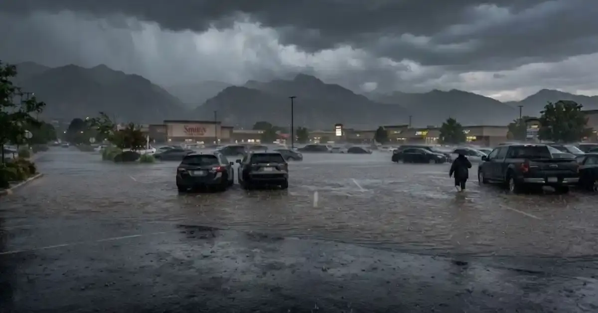
On August 1, 2023, strong thunderstorms dropped roughly 2.5 inches of rain on parts of West Valley City in a matter of hours, before a single drop had even fallen in downtown Salt Lake City. Streets near 5600 West and 3100 South turned into standing water in parking lots and fields. Local news crews captured residents describing garbage cans floating down the road and drivers creating wakes as they pushed through flooded intersections near a local rec center.
That storm is a textbook example of a risk West Valley City's own flood-preparedness guidance calls out specifically: localized thunderstorms present the greatest flood risk throughout the city — not just near the Jordan River, but anywhere, with little to no warning.
What Made The August 2023 Storm Different From River Flooding
Spring snowmelt flooding along the Jordan River is slow and predictable, county and city officials can track snowpack data for months and know roughly when peak runoff will hit. The August 2023 storm was the opposite: a fast-moving thunderstorm cell that dumped more than two inches of rain in a short window, overwhelming storm drains and low-lying areas near 5600 West and 3100 South before the surrounding area even registered rain.
One resident, describing the storm to a local news crew, said she was outside for only five minutes and was "dripping wet." That's the defining feature of this kind of event, it moves from clear skies to standing water in the time it takes to run an errand, with none of the weeks-long lead time that a snowmelt season provides.
Why Every Part Of The City Is Exposed
Unlike Jordan River snowmelt flooding, which concentrates risk near the river corridor, a thunderstorm like the one that hit West Valley City in August 2023 can affect any neighborhood — older Granger and Hunter district streets with drainage systems built decades ago, and newer development near Fairbourne Station alike. Storm drains have a fixed capacity, and a fast enough downpour will overwhelm that capacity regardless of how new or old the surrounding infrastructure is.
This is part of why we don't treat distance from the Jordan River as a meaningful predictor of flood risk during the summer storm season. A property that's never seen snowmelt flooding in its life can still take on water during a severe thunderstorm cell, simply because of how much rain falls in how short a window.
What To Do When A Storm Like This Hits
- Move vehicles and belongings off low-lying ground immediately if you see water starting to pool near your property, the August 2023 storm went from dry to standing water in minutes.
- Check window wells and basement entry points as soon as it's safe to do so after the storm passes, since these are common entry points for storm-driven surface water.
- Don't drive through standing water, several drivers during the August 2023 event created wakes pushing through flooded roads, which isn't just risky for the vehicle but can push water toward nearby homes and businesses.
- Document everything with photos if water does reach your property, since storm damage claims move faster with clear before-and-after documentation of the event.
Storm Damage Often Means More Than Just Water
A severe thunderstorm capable of flooding streets in under an hour is often capable of wind and hail damage too. If your property took on water during a storm like the August 2023 event, it's worth having the roof and siding checked at the same time as any interior water damage — a storm damage restoration assessment covers wind, hail, and water intrusion together, since they frequently arrive as a package during the same weather event rather than as isolated problems.
If water did make it inside, treat it with the same urgency as any other water event: standing water pulled out within hours costs far less to address than water left sitting overnight, even if it looks like "just rainwater."
Thunderstorm Flooding Vs. Snowmelt Flooding, Side By Side
It's worth seeing these two hazards compared directly, since they call for different preparation:
| Factor | Summer Thunderstorm Flooding | Spring Snowmelt Flooding |
|---|---|---|
| Warning time | Minutes to hours | Weeks, via snowpack tracking |
| Geographic pattern | Can strike anywhere in the city | Concentrated near the Jordan River corridor |
| Typical entry point | Surface water through drains, doors, low-lying entries | Groundwater through foundations and window wells |
| 2023 example | 2.5" of rain in hours, 5600 West/3100 South flooding | 270% average snowpack, county state of emergency |
| Best preparation | Clear gutters/drains, know your evacuation routes year-round | Sump pump check, grading review before spring |
The Takeaway For West Valley City Homeowners
Utah's summer thunderstorm season isn't a once-in-a-decade risk, the August 2023 event is a real, documented example of exactly the pattern the city's flood-preparedness materials describe, and it can happen again with the same short notice. The practical response is the same regardless of which neighborhood you're in: know that a fast storm can flood your street even if you're nowhere near the Jordan River, and have a plan, and a restoration crew's number — ready before the next one rolls through.
It's also worth remembering that thunderstorm-driven flooding and river-driven flooding can, in some years, overlap, a wet spring with above-average snowpack followed by an active summer storm season means a property could face both types of risk within a few months of each other. Treating them as two separate, genuinely different hazards, exactly as the city's own guidance does, is a more useful mental model than lumping all "flooding" into one seasonal concern.