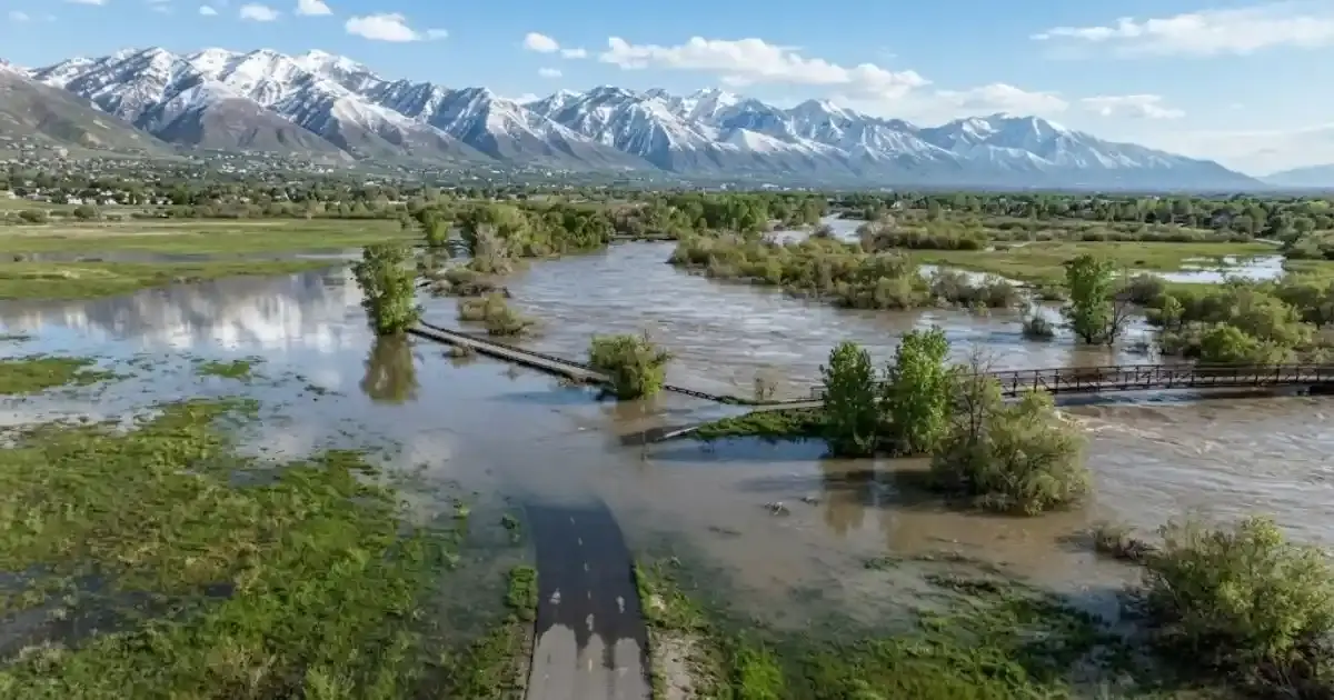
Utah's 2023 snowpack didn't just break records, it forced a statewide response that reshaped how Salt Lake County thinks about spring flood risk. For West Valley City homeowners along the Jordan River corridor, that spring offered a real-world preview of exactly what the city's own flood-preparedness guidance has been warning about for years: predictable, seasonal snowmelt flooding that hits the river corridor hardest, every spring, without fail.
Here's what happened, what it means for the next big snow year, and what to do before the water starts rising.
A Snowpack Unlike Anything On Record
The Wasatch Range snowpack in the spring of 2023 measured roughly 270% of average, described by hydrologists as "uncharted territory" since snowpack measurement began in Utah. By mid-March 2023, the statewide snowpack had already broken the mid-March record, and it kept climbing through early April. Salt Lake County wasn't the only region affected, but its rivers and creeks — including the Jordan River corridor running directly through West Valley City, absorbed a disproportionate share of the runoff as temperatures warmed.
Salt Lake County Mayor Jenny Wilson declared a state of emergency that spring. Salt Lake City did the same. According to county flood control officials, an estimated 500,000 sandbags were distributed across the county as residents in flood-prone neighborhoods scrambled to protect their homes. The total cost to the county from that year's flooding came in at just over $4 million, a number county officials considered relatively fortunate given how close conditions came to matching or exceeding the historic 1983 flood, when Salt Lake City diverted rising water down State Street and 1300 South to protect downtown.
Why West Valley City Watches The Jordan River So Closely
West Valley City's own flood-preparedness page is direct about this: the highest flood risk from spring snowmelt runoff exists specifically along the Jordan River, while localized thunderstorms present a separate, citywide risk that can strike anywhere regardless of the season. These are treated as two distinct hazards by the city for good reason — they behave differently, and they call for different preparation.
Spring snowmelt flooding is slow-building and largely predictable. Unlike a sudden summer storm, there's usually weeks of warning as snowpack data comes in through the winter and early spring. That predictability is exactly why 2023 became such a useful case study: county and city officials had real lead time to coordinate sandbag distribution, clear creek debris, and issue warnings well before the worst of the runoff arrived.
What A Homeowner Near The River Corridor Should Watch For
- Rising groundwater, not just visible flooding. Even when the Jordan River itself stays within its banks, saturated ground near the river can push groundwater up through basement floors and foundation cracks well before any surface flooding is visible.
- Sump pump readiness. A functioning sump pump is one of the most effective, lowest-cost protections against snowmelt-driven groundwater, and one of the most commonly neglected until it's too late.
- Window wells and grading. Landscaping that slopes toward the foundation, or window wells that collect standing water, turn an otherwise manageable snowmelt season into a basement flooding event.
- Insurance coverage gaps. Standard homeowner policies typically exclude flood-specific damage. Snowmelt-driven flooding along a known river corridor is exactly the kind of risk that usually requires separate flood coverage or FEMA Special Flood Hazard Area insurance.
What To Do If Snowmelt Has Already Reached Your Home
If water has entered a basement or lower level from snowmelt-driven groundwater, treat it the same way you would any other water event: get it extracted quickly. The longer water sits, even water that looks "clean" — the more it gets absorbed into flooring, drywall, and framing, turning what could have been a same-day extraction into a multi-day drying project. If the water has been sitting for more than a day or two, or if there's any question about contamination, a full flooded basement cleanup is the safer path rather than attempting to dry things out room by room on your own.
It's also worth having the property checked for hidden moisture even after the visible water is gone. Basements that flood during a snowmelt event sometimes hold moisture in wall cavities or under flooring for weeks afterward, exactly the kind of lingering dampness that leads to a mold problem showing up a month or two later, long after everyone's stopped thinking about the flood.
Snowmelt Flooding Vs. Thunderstorm Flooding, Side By Side
West Valley City's flood-preparedness guidance treats these as two genuinely different hazards. Here's how they actually compare:
| Factor | Spring Snowmelt Flooding | Summer Thunderstorm Flooding |
|---|---|---|
| Warning time | Weeks, via snowpack tracking | Minutes to hours |
| Geographic pattern | Concentrated near the Jordan River corridor | Can strike anywhere in the city |
| Typical entry point | Groundwater through foundations and window wells | Surface water through drains, doors, low-lying entries |
| 2023 example | 270% average snowpack, county state of emergency | 2.5" of rain in hours, 5600 West/3100 South flooding |
| Best preparation | Sump pump check, grading review before spring | Clear gutters/drains, know your evacuation routes year-round |
A Seasonal Risk Worth Planning For, Not Panicking Over
2023 was an outlier year, but the underlying risk it exposed isn't going anywhere. The Jordan River corridor will see elevated flood risk again in any year with an above-average snowpack, and West Valley City's own preparedness guidance reflects that reality. The practical response isn't dread, it's the same short checklist every spring: know your flood zone, keep your sump pump serviced, watch the snowpack reports through late winter, and have a restoration crew's number on hand before you need it, not after.